
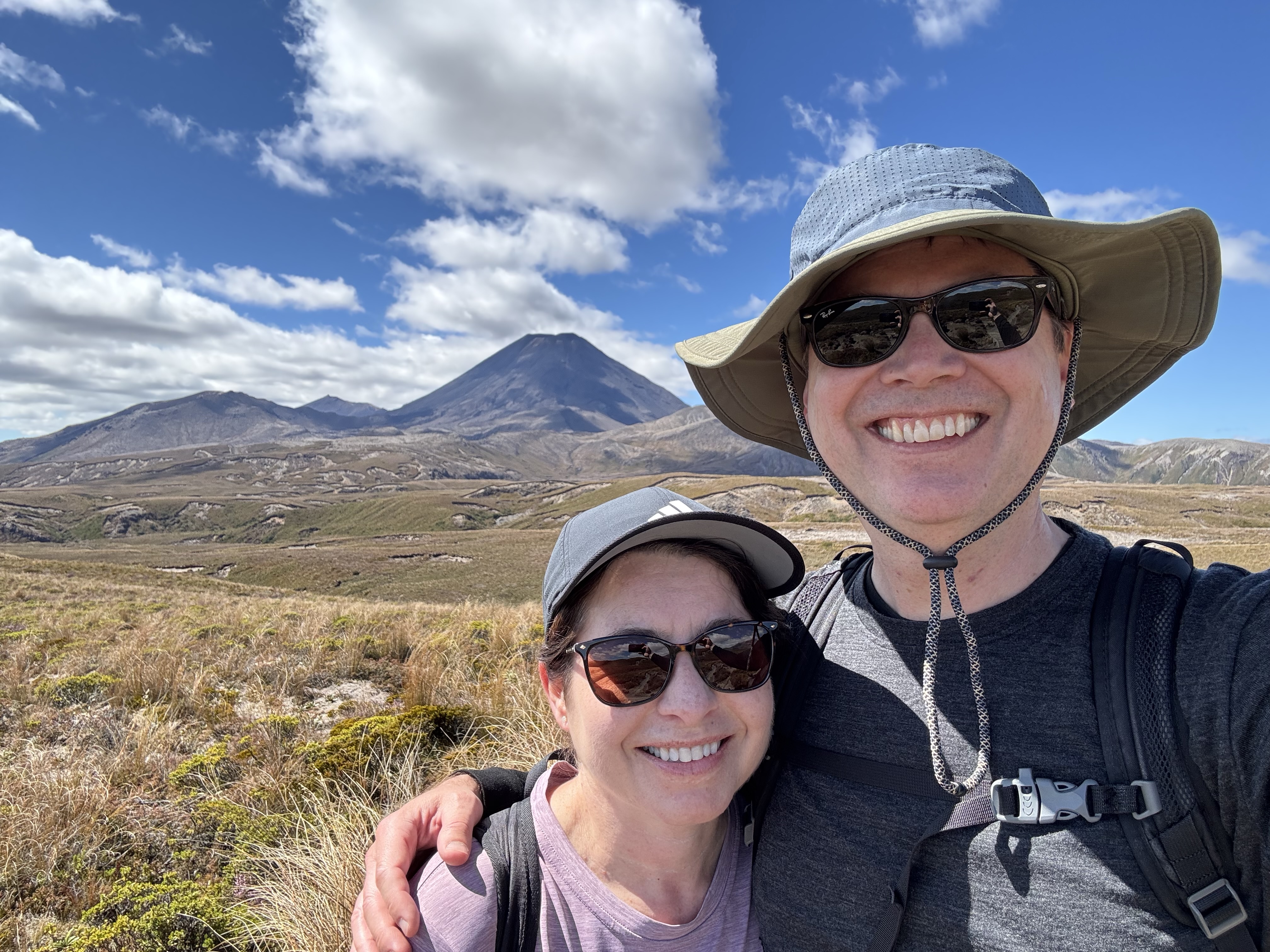
The Tongariro is a mountainous national park in the middle of the north island. The volcanoes of the Tongariro are part of what is known as the Pacific Ring of Fire (where there are major collisions between plates in the Earth’s crust around the rim of the Pacific Ocean). These volcanoes have been active for thousands of years and they still erupt very frequently by world standards. Two of them, Mount Ruapehu and Mount Ngāuruhoe have both erupted many times in the last 100 years.
The park is a popular hiking area, which is what brought us there. We camped for two nights in Whakapapa Village, where several trails start and where the visitor center is located. Whakapapa Village was founded in the 1920s by skiing enthusiasts. In 1929, a hotel called Chateau Tongariro was built, and Whakapapa Village became a thriving destination in winter. The visitor center had lots of trail information, including a relief model of the park, which was helpful to understand the terrain.


The most popular hike there is called the Tongariro Alpine Crossing – a nearly 20km (12 miles) one day trek across a volcanic landscape through old lava flows and craters, and next to vivid colored lakes. You can only do it in good weather conditions and you need to arrange shuttles to bring you to the start and pick you up at the end of the trek. It was closed down the day we arrived due to winds speeds of over 100km/h (62m/h). Based on some advice from other locals and travelers, we decided on a different trek which was a bit less complicated, but still provided amazing views. Called the Tama Lakes Trek, it was almost as long and climbed nearly 1800 feet, but we didn’t need a shuttle or worry about the weather.
The trail started near our campground, so we didn’t have to drive anywhere, which was very nice. The first section called the Upper Taranaki Falls Track climbed along several ridges with interesting plants growing on the volcanic soil. To our left we could see Mount Ngāuruhoe, a perfectly shaped volcano that would get larger and larger as we trekked closer to it. Some of you might recognize it as Mount Doom in the Lord of the Rings trilogy. To our right was the massive Mount Ruapehu with snow still visible in crevices around its peak. This is where the ski resorts are located.


After about an hour of hiking, we arrived at the top of Taranaki Falls where the Tama Lakes Track started. This trail wound its way over more ridges closer and closer to the volcano until we finally reached the lower Tama Lake Viewpoint, where we could see the first impressive crater lake. We stopped there to have lunch at the cliff edge sitting on soft ground cover. We were protected from the wind, and the sun was shining down on us. Great place for a picnic!


The final part of the trail climbed steeply up the side of a volcano on loose rocks and scree. We carefully cut diagonally back and forth making sure we had solid footing before the next step. The view from the top revealed the second lake and fantastic 360 degree views.


Now we had to go back down, which was actually a bit trickier than going up. Luckily we had good hiking boots and took our time to avoid slipping too much. We followed the same trail back to the falls. It was actually nice going back in the other direction, as we got different viewpoints. Also, the sun had changed positions since the morning giving the scenery a new look.
I couldn’t help thinking about all the active volcanoes around us and where we might seek cover if one started erupting. There were signs of previous volcanic activity everywhere – including massive boulders spewed out randomly during particularly violent eruptions, called volcanic blocks – one of the largest one ejected from the crater of Mount Ruapehu in 1995 was about 2 meters (6.5 feet) across and weighed 10 tons – and volcanic bombs, which can be even bigger. As we were walking, we did notice some smoke rising in the distance. We asked some local hikers if they knew what it was, but they didn’t. It could have been a fire, some geothermal steam, or…. maybe a volcano? We never did find out.


Once we got back to the falls, we took the Lower Taranaki Falls Track. This brought us down a cliff where the full glory of the falls were revealed amongst a green, forested hidden valley. This was such a kiwi moment – after spending hours in harsh volcanic environments, there was this beautiful, lush waterfall literally around a corner. The remainder of the trail followed the forested gorge along the river and was an energizing way to end the hike which was now in its fifth hour.


We felt good as we finished the hike and were surprisingly not even stiff after it. This gave us confidence that we could tackle the famous Tongariro Alpine Crossing the next time we come! When we got back to our campground, we took showers then grilled up some New Zealand lamb chops, squash and cabbage to enjoy with the red wine we had bought in Napier. Great meal, we deserved it! 🙂


Leave a Reply